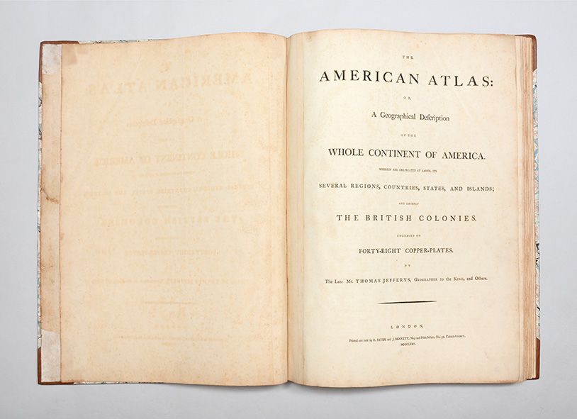
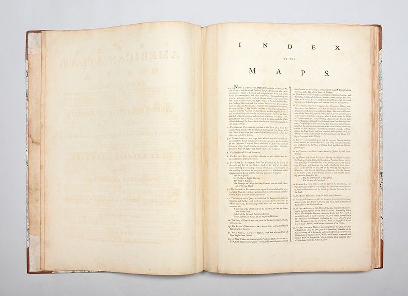
The American Atlas: or, A Geographical Defcription of the Whole Continent of America. Wherein are Delineated at Large, its Several Regions, Countries, States, and Islands; and Chiefly the British Colonies. Engraved on Forty-Eight Copper-Plates. By the Late Mr. Thomas Jefferys, Geographer to the King, and Others.
London: Printed and Sold by R. Sayer and J. Bennett, 1775.
The American Atlas: or, A Geographical Defcription of the Whole Continent of America. Wherein are Delineated at Large, its Several Regions, Countries, States, and Islands; and Chiefly the British Colonies. Engraved on Forty-Eight Copper-Plates. By the Late Mr. Thomas Jefferys, Geographer to the King, and Others.
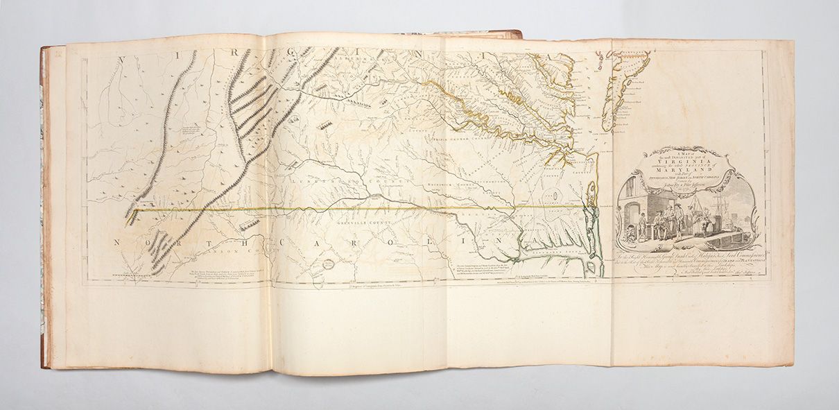
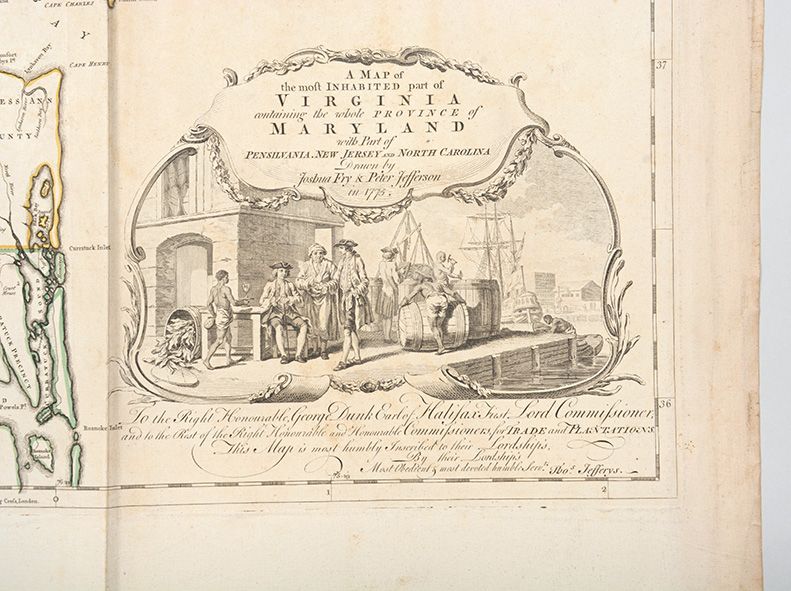
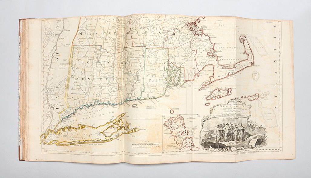
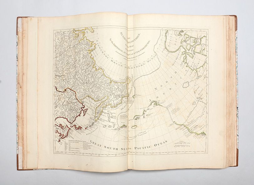
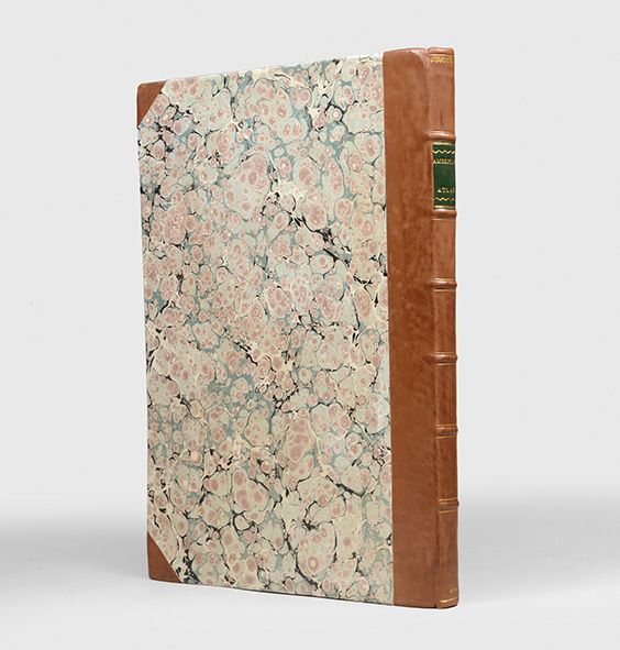
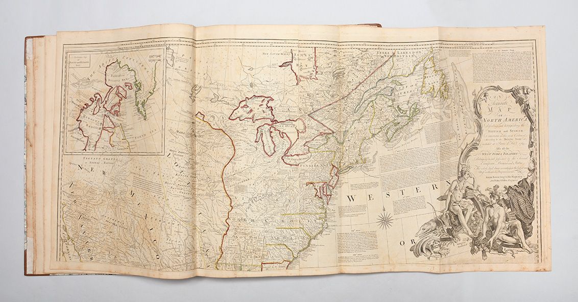
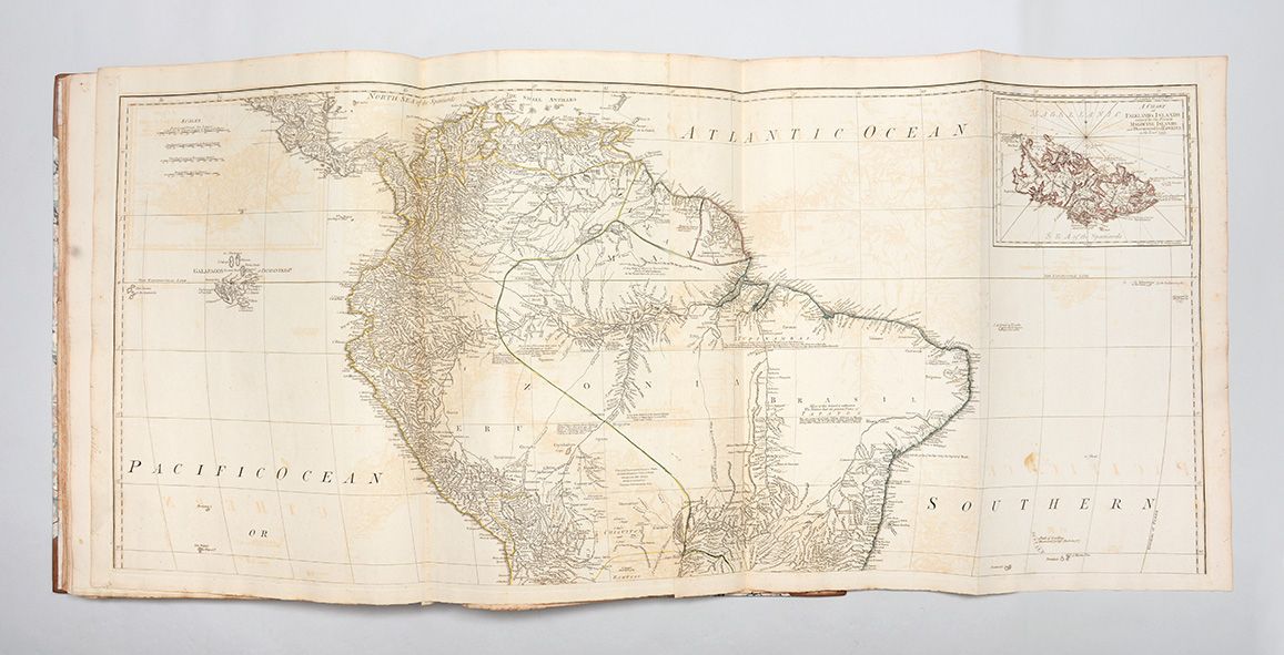
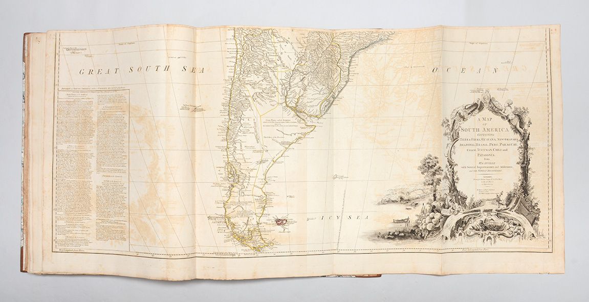
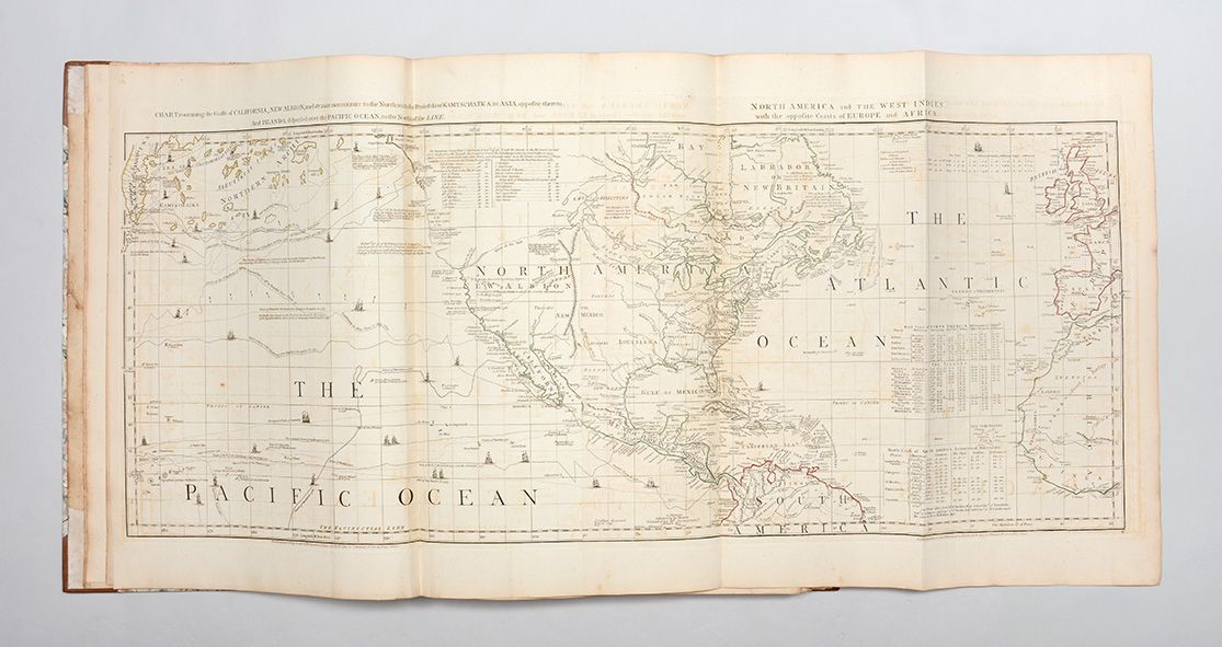
London: Printed and Sold by R. Sayer and J. Bennett, 1775. First edition. Folio (558 x 396 mm). Recent half calf period style, marbled sides. Some pale offsetting and occasional dust marking. A very good copy. Letterpress title and index leaf. 22 engraved maps on 48 sheets (all folding or double-page except for one single-page) by Henry Mouzon, Joshua Fry & Peter Jefferson, William Scull, Thomas Jefferys, Samuel Holland and others, hand-coloured in outline, each numbered in manuscript at the top corner. First edition of this celebrated atlas, "the chief publication used by English and American officers during the American Revolution" (Karpinski) and "one of the most authoritative and comprehensive atlases of America" (Ristow), with large maps of 11 of the 13 colonies, and of French Canada. As Geographer to the Prince of Wales, and subsequently George III, Jefferys had unparalleled access to the latest surveys of the American colonies and "is remembered in particular for some of the most important eighteenth-century maps of the Americas, a series given cohesion and impetus by the preliminary hostilities and eventual outbreak of the Seven Years' War" (ODNB). After Jefferys' death in November 1771, his business passed to Robert Sayer and John Bennett, who, in 1775, issued all of Jefferys' separately issued maps in atlas form for the first time, under the umbrella title The American Atlas. This is considered to be the most important eighteenth-century atlas for America, described by Walter Ristow as "a geographical description of the whole continent of America, as portrayed in the best available maps in the latter half of the eighteenth century as a major cartographic reference work it was, very likely, consulted by American, English, and French civilian administrators and military officers during the Revolution". The geographical knowledge of America gathered here was to have impact not only on the strategy of the War of Independence, but also influenced the course of future treaty negotiations. The maps comprise: 1, 2, 3: Braddock Mead (alias John Green). "A Chart of North and South America, including the Atlantic and Pacific Oceans " Published 10 June 1775. Six sheets joined into three. 4: Imperial Academy of St. Petersburg. "The Russian Discoveries." Published 2 March 1775. One sheet. 5, 6: Emanuel Bowen and John Gibson. "An Accurate Map of North America Describing and distinguishing the British and Spanish Dominions." Published 2 July 1775. Four sheets joined into two. 7: Thomas Jefferys. "North America from the French of Mr. D'Anville." Published 10 June 1775. One sheet. 8: Samuel Dunn. "A Map of the British Empire in North America." Published 10 January 1774. One sheet. 9: Thomas Jefferys. "An Exact Chart of the River St. Laurence from Fort Frontenac to the Island of Anticosti." Published 25 May 1775. Two sheets joined into one. 10: Sayer and Bennett. "A Chart of the Gulf of St. Laurence " Published 25 March 1775. One sheet. 11: "A Map of the Island of St. John in the Gulf of St. Laurence." Published 6 April 1775. One sheet. 12: James Cook and Michael Lane. "A General Chart of the Island of Newfoundland." Published 10 May 1775. One sheet. 13: "A Chart of the Banks of Newfoundland." Published 25 March 1775. One sheet. 14: Thomas Jefferys. "A New Map of Nova Scotia and Cape Breton Island with the adjacent parts of New England and Canada." Published 15 June 1775. One sheet. 15, 16: Braddock Mead (alias John Green). "A Map of the Most Inhabited Part of New England." Published 29 November 1774. Four sheets joined into two. 17: Samuel Holland. "The Provinces of New York and New Jersey; with part of Pensilvania, and the Governments of Trois Rivieres, and Montreal." Published 15 June 1775. Two sheets joined into one. 18: Thomas Jefferys. "A general Map of The Middle British Colonies." Published 15 June 1775. One sheet. 19: William Scull. "A Map of Pennsylvania Exhibiting not only the Improved Parts of the Province but also its Extensive Frontiers." Published 10 June 1775. Two sheets joined into one. 20, 21: Joshua Fry and Peter Jefferson. "A Map of the Most Inhabited Part of Virginia containing the whole Province of Maryland with Part of Pensilvania, New Jersey and North Carolina." Undated. Four sheets joined into two. 22, 23: Henry Mouzon. "An Accurate Map of North and South Carolina with their Indian Frontiers." Published 30 May 1775. Four sheets joined into two. 24: Thomas Jefferys. "The Coast of West Florida and Louisiana." Published 20 February 1775. Two sheets joined into one. 25: Lieut. Ross. "Course of the River Mississipi [sic] Taken from the Expedition to Illinois in the latter end of the year 1765." Published 1 June 1775. Two sheets joined into one. 26: Thomas Jefferys. "The Bay of Honduras." Published 20 February 1775. One sheet. 27, 28: J.B.B. D'Anville. "A Map of South America " Published 20 September 1775. Four sheets joined into two. 29: Cruz Cano, et al. "A Chart of the Straits of Magellan." Published 1 July 1775. One sheet. (Item #3500)